Monday, December 28, 2015

Washington: Rainy Pass to Manning Park Canada Eh? (Plus Crater Lake)

The Last Section!

Trail Angel George once again rescued us at the Rainy Pass trailhead.  He asked some other hikers about us and they confirmed we weren't far behind.  In fact, we had told Hobbit Feet to tell George we were on our way and that he should give her beer which he did.  Also, we had been passing the word around that we had found a hiker wallet and to keep an eye out for someone looking for it.  Well, George found a posted note at the trailhead advertising a lost wallet and sure enough it was the same name of the wallet we found!  The trail community really is a small world.  On the back side of the lost wallet note that George found was another note that the same person had also lost their rain pants.  Way back near Snoqualmie pass.  The same rain pants Robin found and carried to Stevens pass and left in George's car!!!  Yup, we found his rain pants and his wallet.  He's one lucky (ahem,shitshow) that we found both and also happened to live in Seattle!! (we returned both items to him in Seattle when we got home)

We spent a night in Winthrop WA at the KOA.  It was a great night, with a campfire and beers.  We met a woman and her 9 yr old daughter who became interested in our hiking adventure.  We shared stories around the fire with them and Starboard was super excited to hear that the young girl was inspired to try hiking the trail when she reached 20 years.  It's amazingly satisfying to feel you've inspired just one person to think big and envision living their own dream.  We sincerely hope she does try hiking the PCT or whatever adventure she thinks of by 2026!

As nice as it was to relax in Winthrop, the weather forecast insisted that we get back on trail the next day (Tuesday 29th).  We desperately wanted and needed a day off.  We had not taken a zero day since Cascade Locks back on Sept 5th.  Robin's knee could use the rest.  This is part of the challenge of hiking the PCT: start late enough to make it through the Sierra after the snow melts, but hike fast enough to finish Washington before the snow falls again. (It's easily doable, but boy were we slow hikers!) We had a few rough days in the cold rain and we did not like it much.  The idea of struggling through the cold snow in this remote section was not very appealing.  So, with the weather forecasting dry and sunny for at least 4 more days, we decided we had to keep hiking.  The northern terminus and Manning Park was only a short 4 days away.  If we delayed hiking for a rest day, we risked hiking in the rain for the last day or two.

(Day 170, Sept 29th, Mile 2588.9-2599.3, hiked 10.4 miles)

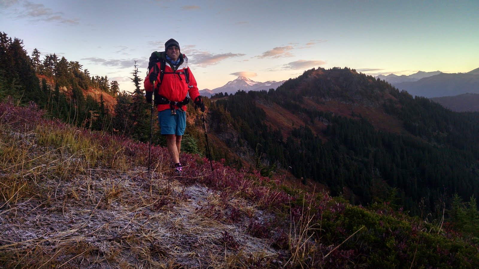
Robin's knee was feeling better and the sun was shining.  Good Time tried to drink as many beers as possible before they kicked him back out of the van and onto the trail!
Sunny on Cutthroat Pass


What do you want Starboard?


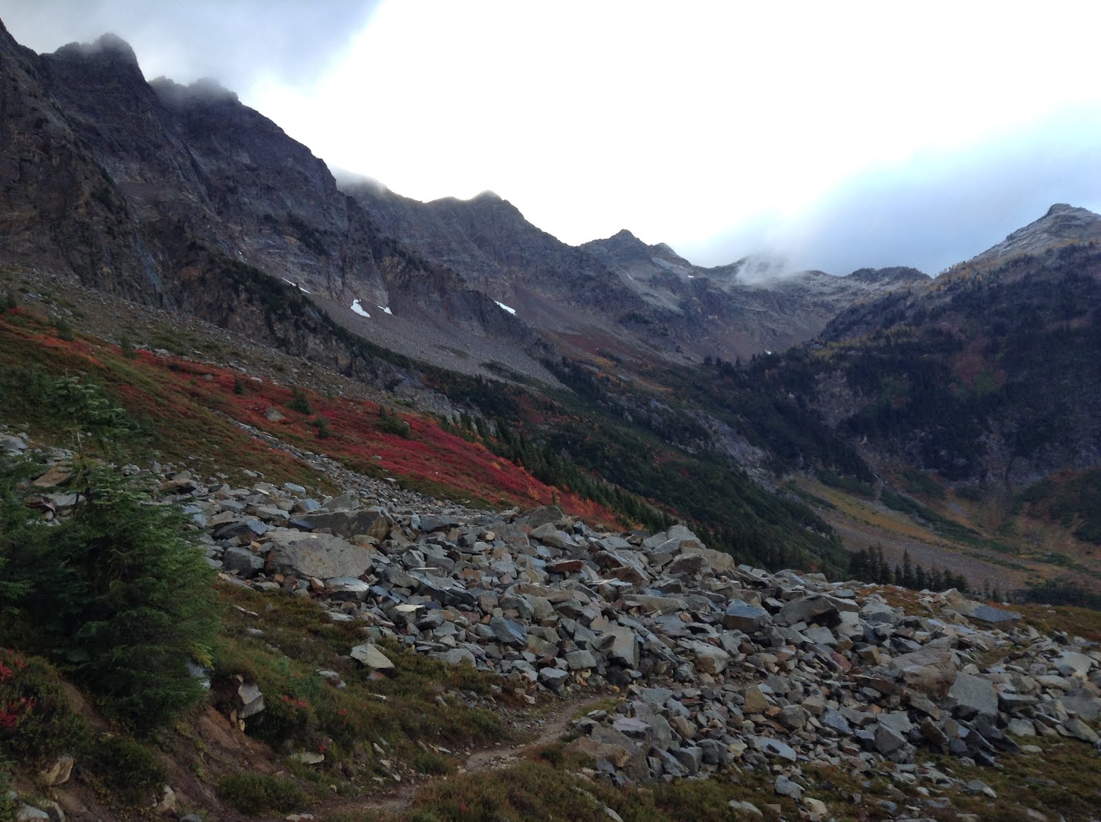
The glaciated landscape of Washington, near Granite Pass - Yes, that line on the ridge to the right is the trail.


Starboard near Granite Pass


We managed to pass some trail magic to others at the Rainy Pass trailhead.  We left some beers and some mini-champagne bottles that ended up with Sass.
Starboard left her headlight in the van.  This was the 2nd time she forgot her headlamp:(  woops.
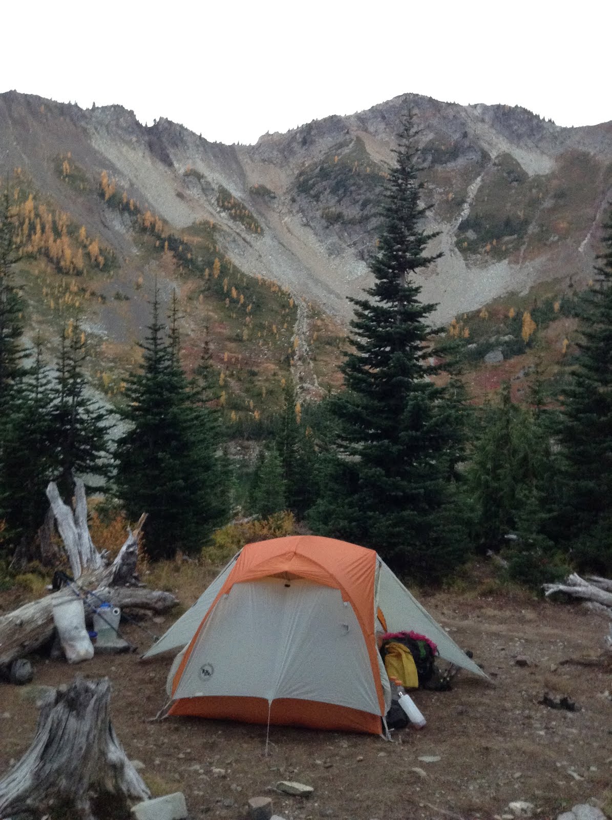
Methow Pass was an awesome spot to camp, one of our best on the trail.


Methow Pass Campsite, one of our best on the trail!


(Day  171 September 30th, mile 2599.3 to 2623.1, hiked 23.8 miles.)
This was a nice day of walking with a pretty sunrise dotted with stars and the moon.  This was to be an amazing day in that we didn't see any other through-hikers the entire day!  And the weather was decent enough that we were able to eat outside of the tent as we stopped early enough to have a little daylight left.

Morning, heading North from Methow Pass


Also, we made it to the 2600 mile marker!  The next milestone would be the border!

Last Mile marker!  Wow!


Beautiful Fall hiking


Nice spot for a break


We were starting to get really close to finishing the trail!  We were having great hiking weather, and this last section was really pretty.  Yet, we were both ready to be finished hiking.  We started thinking about sleeping indoors. Eating eating eating. Showering.  Clean laundry.  Not having to dig a cathole every morning.
We also were trying to make a logistical plan to go back to Crater Lake and finish hiking the 23 miles we missed due to the wildfire there.  All of these thoughts just made us want more and more to be finished.  Or at least to be at the border so we could hurry up and drive back to Oregon.  A real pressing sense of hurry.


Camp spot about a half mile south of Buffalo Pass


(Day 172, October 1st, mile 2623.1 to 2643.7, hiked 20.6 miles.)

Another day of great weather and nice walking.  This would finally be our last day full day on trail including camping at the end of the day.  Amazing.


Another fine morning


Tra la la....


We finally started running into hikers again.  We met a few hikers who had tagged the border monument and were hiking southbound back to Hart's Pass for a ride back to the world.  Congratulations all around for their success and our anticipated success.  Still, we talked about how demoralizing it would be to touch the border and then walk thirty miles back towards the south.  From the border monument, it's only about 9 miles to Manning Park and a bus ride to anywhere.  After all that walking, a short nine miles sounded a lot better than 30 miles, and even so Hart's Pass is pretty remote, on a dirt road.
That being said, one does need an entry permit to walk into Canada.  And there are certain reasons that Canada may not grant an entry permit.  We had our permits in hand and always had planned on walking to Manning Park, where Trail Angel Nancy was planning to pick us up.


More fine fall weather


Near Hopkins Pass


We also started seeing some Northbound hikers too.  It was quite fascinating that we were still meeting new people on the trail after all this time!  We camped at a nice lake (Hopkins Lake) for our last night on the trail.  All the anticipation to finish, and I still slept like a dead person.

Our last campsite on the trail, Hopkins lake


Day 173, October 2nd 2015.  mile 2643.7 to  2650.1, hiked 6.4 miles to Monument 78 the Canadian Border Monument!!!  We made it!!
(and then we hiked from 2650.1 to 2658.91 (8.81 miles) to Manning Park)


Our beards really filled in nicely the last few days


The day before Sass and Skeeter Bait finally caught up to us on Hopkins Pass.  We had been hearing rumors that they were somewhere behind us and we were so happy to see them again.  And we were happy to be finishing with these awesome women who we'd seen off and on since Cajon Pass (mile 341 ) and Carson Pass (mile 1076 )


We were so excited to finally touch the monument!  When we arrived we started hooting and hollering and some guys who were already there cheered us on!  We didn't know them, as they were southbound section hikers, but they were nice and took pictures for us.


We made it!  And we're still talking to each other!!


Then, Starboard and I had the monument to ourselves for a few minutes which was kind of nice.
Soon enough we could hear Sass and Skeeter Bait approaching and then it was hugs and congratulations all around!


We all had some celebration champagne and had a great time celebrating at the monument.

Goodtime, Starboard, Skeeter Bait and Sass celebrating

The next 8 miles were a wonderment.  They were agonizing.  We just wanted to be done hiking.  But they were also surreal.  Really?  We just thru-hiked the Pacific Crest Trail from Mexico?  Holy shit!  We really are almost done.  Wait, really?  We're still on the trail?

It was a giddy, yet melancholy hike into Manning Park.  We talked about the logistics of getting back down to Crater Lake to complete the skipped miles.  We wondered about our other trail friends who we hadn't seen for a while.
We wondered just how many beers we could drink tonight?  How much food could we eat?
We were excited that we would not have to hike tomorrow.  Finally.


We popped out on the road and there was Trail Angel Nancy again!  Woohoo!!! She had cold beverages for us, and a ride in a car the last tiny bit to the Manning Park lodge.  Hot showers, restaurant meals and a bed.  Nice.


We had a plan.  We left Manning Park the next morning, Oct 3rd and drove to Washington to collect our travel van.  We managed to drop off the rain pants and wallet we had found on the trail to the owner in Seattle. We spent a brief night at home doing some laundry and left the next day.  Oct 4th we drove back down to Crater Lake, OR to complete the miles we had to skip due to the wildfire in August.
(We had arrived in Mazama Village on August 18th, just after the PCT had been closed due to wildfire.  At the time, we had tried to come up with a reroute to continuously walk the PCT without skipping.  In the end, we found the lack of water resources along the reroute to be too risky.  We caught a car ride around the fire closure from Mazama Village to Highway 138, having to skip approximately 23 trail miles between 1819 and 1845 along the Crater Lake Rim Alternate.)

It was actually exciting to be back in Oregon.  But also funny to drive so fast through so much distance that had taken us so much more time to walk.

(Day 176, October 5th.  Mile 1819.2-1845.32; approx 23 miles along the Crater Lake Rim Trail alternate)
We got up early on Oct 5th to hike from Mazama Village to Highway 138.  It was amazing how much different Mazama was now.  In the summer, it was a very busy place.  Lots of tourists and lots of hiker trash.  The campground had been full.  The parking lot was full.  The store was a real buzz of activity all the time.  Now, in October?  Nothing.  The campground was closed.  The store was mostly closed.  The hotel was closed for the season.  The parking lot was empty.  There was almost nobody around.  We had the trail to ourselves almost.


Back to the Scene
Are you ready?


It was a crisp morning, but a gorgeous day.  We slogged up the hill, anticipating great views of the lake and the scenery to come.  We argued about where we would find water.
And then there it was.  Crater Lake.  Awesome.


Voila!


We had a nice lunch and then enjoyed the views around the lake.


Crater Lake
We're still having fun?


Mt Thielsen in the distance, with some puffs of smoke from the forest fire that was still burning


Soon, we were North of the lake and back into the trees of Oregon.  Now we had about 9 more miles to hike to Highway 138 and our completion of the PCT.  Nine long, boring agonizing miles.  Now we really did just want to be done.  It was a beautiful day for hiking.  But we'd had a lot of beautiful hiking days.
And then we were finished.

I'm Done!
Return to our drop off spot


We crossed Highway 138 and tagged the PCT sign on the tree at the trail where we had been dropped off after skipping around the Crater Lake Fire Closure back in August.  We made it.  We finished.  Good Time Grant and Starboard hiked the entire Pacific Crest Trail.  Woohoo!!!!

Starboard had stashed a bottle of champagne in the woods to celebrate with and we stood around smiling and laughing and drinking champagne to celebrate.  Amazing.

We just hiked the entire Pacific Crest Trail!

Friday, December 18, 2015

Washington: Stevens Pass to Rainy Pass

Back on the Trail, Again

(Day 163, Sept 22nd, Leaving Stevens Pass: Mile 2461.6 to Mile 2475.3, hiked 13.7 miles)

We actually made it back to Stevens Pass at a reasonable hour (after spending the night in Leavenworth, WA) but I was still thirsty and Trail Angel George was obliging so we drank some beer in the parking lot.  We were reluctant to saddle up our resupplied packs for the next seven-day slog and we watched all the other happy hikers returning to the trail and leaving before us.  The weather was sunny and warm and good for hiking (and good for sitting in the parking lot drinking beer).  We heard rumors of rain in the forecast but we would have to gamble.
We had a nice day of hiking but someone passed us late in the day and snagged the campsite we had planned for.  It was quite surprising how busy the trail still was in September toward the end of our hike and the end of the hiking season.  Due to the difficult terrain, there were also fewer and far-between spots to choose from.  We weren't expecting the competition for good campsites this late in the hiking season!  Nevertheless, we found a nice little spot for the night.


Perfectly fine camping, if you don't mind losing your fuel and your sunglasses.  I slept great.


This is where the wheels started to come off.  The first night of the 7-day stretch my cook stove malfunctioned.  My flame wouldn't work correctly and I fiddled with the stove for a bit before giving up and letting Starboard boil water for my meal.  Not a problem.  Except as an engineer I'm never satisfied with just declaring the stove broken and moving on.  Oh no.


(Day 164, Sept 23rd.  Mile 2475.3-2495.7,  hiked 20.4 miles)
 So I decided to try the stove again in the morning for coffee.  Success!  Or so I thought.  Instead, after boiling water and turning off the stove, I left the stove and fuel canister connected and somehow most of the canister emptied itself!!  Being tired and groggy I didn't realize what happened until I was packing up the stove.  The canister felt both cold and light.  It should still have been almost completely full. I compared weight with Robin's still full canister and mine was definitely lighter.  Somehow a lot of my fuel had leaked out while I was drinking coffee. Bummer!
This was only day two and now we were already thinking about fuel conservation since I might be out of fuel!  Still, we talked through our options and we felt confident that by skimping on our fuel use we would be fine.


Crisp but pretty, Henry M Jackson Wilderness

And that's the campsite where Robin left her sunglasses.  D'oh!!  So maybe not our best campsite after all.....

We set off to hiking in the chilly morning with our morning business chores still to be done with.  And then disaster struck again!  After more than 2400 miles of faithful almost daily service, the terrain proved too tough for Starboard's digging trowel and it snapped!  Man oh man.....

And then Starboard's knee started hurting.  This was a pain she's been battling for years.  Yet, she had been pain free for 2400 miles!  And now it starts hurting?  What the f**cats??  This really was a desperate problem.  We were carrying an ace bandage and some high-octane pain killers just in case.  But we're also only one day away from a major highway. We could walk back out. But that's backwards to Highway 2.  Or, alternatively, we still have 6 days of hiking to make it to Rainy Pass for our next resupply.  Should we turn around now and rest Robin's knee?  Or should we limp it along and hike at a slower pace for a few days to see how she feels?  Also, I just wasted (lost) a bunch of fuel.  And the weather forecast isn't totally awesome either.  
We looked at the maps and the Yogi guide and decide that since there is a decent hiker bail-out trail a few days away we should keep going.  But the pain and agony for Starboard becomes very frustrating.  
We quickly deploy the ace bandage for starters.  We consider stopping early for the day and just resting in the sun to give her knee a break.  In the end, we keep on hiking just like every day since crossing the Columbia River.  She's a mule!

A few miles into our morning we meet a hiker heading the other way.  He's a hiker we met the day before at Stevens Pass, hiking North just like us.  We're all confused.  We ask him if he was Southbound?  He asks us if we turned around and were Southbounding for some reason?  But he was hiking faster than us yesterday and was supposed to be ahead of us somewhere this morning.  How could we have passed him?  We did some map consulting and it turns out he had been hiking South for about 30 minutes for the start of his day!  Whoops!  Everybody laughed and headed North again together.  (We heard lots of these stories about hikers getting back on trail and inadvertently walking in the wrong direction.  Sometimes for hours.  Hilarious, though disheartening.)

The hiking and the weather was decent and Robin suffered admirably along.  This was actually one of the more challenging sections.  It's approximately 127 miles from highway 2 at Steven's Pass to highway 20 at Rainy Pass.  It's quite remote.  Stehekin is approximately 107 miles north of highway 2.  And that's pretty much it.  There's a trail or two where you can walk out to another road to somewhere.  But even those 'outs' are about 8 or so miles from the PCT trail.  And once at the trailhead, you still have to find a ride to a town.
Also, the elevation profile is quite challenging.  According to Halfmile, this 127 mile section involves approximately 31,800' of up hiking and 31,015' of down walking.  That's a lot of up and down!  Yes, it was steep at times!

We camped in a cold little saddle near the Indian Creek trail junction.  It was pretty damp and cold strangely.  Luckily it still wasn't raining and we had a decent day of hiking in overcast weather.  This is the day we would meet the trail junction to the North Fork of the Sauk river.  This was our chance to bail out and rest for a few days if Robin really couldn't walk on her knee anymore.  The weather was definitely changing for the worse.  We had about 4 miles to hike to make our choice.


Glacier Peaks Wilderness near Indian Pass


(Day 165, Sept 24th.  Mile 2495.7-2515.3;  hiked 19.6 miles)
There was never really a choice.  Starboard had no intention of stopping.  And I'm glad we kept going.  Logistically, it would have been difficult to hike out to the road and then have to hike back in another 8 miles or more just to rejoin the trail.  Better to just slog on through and hope for the best!
We were concerned about moving slowly though.  And we had somehow misjudged our distance from Highway 2.  We somehow missed 10 miles and 10,000 feet of elevation change when we made our tentative schedule.  So now, not only were we running low on fuel, we had an extra 10 miles to hike we hadn't accounted for.  This would change our eta to Rainy pass a little bit.  So now we were worried that Starboard's father would be worried about us not showing up on time at the Rainy pass trailhead where he was meeting us with our final resupply.


Ahhhh,......Washington


We got lucky and met a great local hiker just about where the trail junction for the bailout point was.  (This was also right about at the 2500 mile marker.)  We discussed our problems and finally decided to send a message with the local hiker who was hiking back out to civilization.  She offered to call Starboard's parents and brother to try and relay the message that we would be late to Rainy Pass, but not to worry about us.  We even tried to convey the plan that Starboard's family could maybe drive a car and leave it at the trailhead for us for whenever we would show up, giving details about where to leave the keys and everything.
We had been rationing our fuel and sharing a stove, so we were pretty confident that our food and fuel would be enough to make it to Rainy Pass regardless.  Besides, what's a day or so of cold food and hunger after 2500 miles?

We met a few hikers to take pictures for the 2500 mile marker and followed them all down the trail.  The weather was still decent, though threatening to rain or snow.  Starboard was still going strong despite the knee pain. 
We found a great campsite in a small cirque near Fire creek and were surprised to have it to ourselves after seeing so many hikers.  We wanted to make it up over the next pass but we were tired and it was just too far.  It was almost dark when we set up our tent anyway.  We did see a few headlamps and heard some other hikers pass us by after we were in the tent anyway.


And the wheels are coming off...broken trowel, bad knee, cold weather.


Still together after 2500...


See?  I told you the first 2500 miles would be worth it!!


Then the trail started to deteriorate.  And how.  I would say this section, from approximately mile 2510 to 2532 were the most difficult hiking along the entire trail.  Not kidding.  There were a few reasons for this.  First, the trail appeared to have been all but abandoned.  Lots of logs across the trail.  Lots of trail washouts.  Lots of overgrowth in the trail.  There had been almost no trail maintenance here it seemed.  Then, it started raining.  And boy did it rain. It's a good thing we had our rain pants! Also, this section was really steep.  This is one of the more remote sections that goes around the west side of Glacier Peak.
It turns out, this section has been abandoned!  Not intentionally, but two or three major storms since 2003 have made it difficult to do trail maintenance on this remote section.
Check out this write-up about the trail from the PCTA.

http://www.pcta.org/2015/glacier-peak-wilderness-finally-ready-for-project-planning-35623/

Considering the challenge to repair, we were lucky to have trail at all!


One of the easier log crossings - good thing we're short!


Kennedy Creek?  This was one of the better spots....

(Day 166, Sept 25th.  Mile 2515.3-2532.7; hiked 17.4 miles in the rain)
 Did I mention the trail was steep?  According to Halfmile, the difficult 17-mile day from Fire creek to Vista creek we hiked uphill 5400' and downhill 7065' !  Did I also mention that the downhill hiking is what really hurts Robin's knee? This was the day Starboard needed a little extra boost to her Ibuprofen dose.  Modern medicine is amazing.  She was a much happier hiker when she was pain free.

Enjoying the rain on Fire Creek Pass
Dropping down from Fire Creek Pass toward Mica Lake


Enjoying the view at Milk Creek


Tra la la la la-ing in the rain, descending to Vista Creek


The next night we camped at Vista creek and immediately the trail improved. It was like night and day how much nicer the trail was.

(Day 167, Sept 26th.  Mile 2532.7 - 2554.6; hiked 21.9 miles)

This was clearly the latest stopping point of the trail maintenance crew.  It's amazing how much our pace quickened by the expertly repaired trail.  And the bridge over the Suiattle river was amazing.  In fact, we had a rare patch of sunshine on the bridge, and I stayed an extra 45 minutes after Starboard left from our morning break to let the tent dry out in the patch of sun.  Wise decision too, as we had another cold damp night after hiking through some snow over Suiattle Pass.


Drying out the tent, Suiattle River Bridge PCT


North of Suiattle Pass


And we met Pistol Pete the Porcupine.  Followed him down the trail for almost thirty minutes too.  He didn't really like us hiking behind him, and everytime we would get a little too close he would speed up and waddle down the trial.  Let me just say that's it's hilarious watching a porcupine try to run down the trail!  At one point, we decided we should go off trail and try to get ahead of the slow moving beast.  But he was way smarter than us and cut the switchback first!  Danggit!  Then we saw an opportunity to get ahead again if we went cross-country to the trail.  So off we went, scrambling through the wet brush and rocks.  Just before we made it back onto the trail, there goes Pete, ambling by ahead of us!  Danggit again!  That guy was way smarter than we were and we resigned ourselves to being stuck behind him for as long as he stayed on the trail.  We didn't want to get stickered by his quills!
Luckily, he finally got tired of us following and he wandered off the trail and up into the moraine rocks.


Chasin' Pistol Pete the Porcupine

(Day 168, Sept 27th Mile 2554.6-2574.3; hiked 19.7 miles)
Cold in the morning, but another pretty day.  We somehow found a wallet on the trail.  We would not have seen it, but it was sitting on a log in an established campsite and it was lunchtime so we stopped to get water and eat lunch.  After rummaging through the wallet we determined it was nobody we knew.  We decided to carry it because even if we never found the owner, leaving it in the middle of nowhere in the wilderness didn't seem like a great option.  Also, the ID showed a Seattle address and we guessed that at the very minimum we might be able to deliver it home after we finished the trail.

There's a funny little conundrum in the North Cascades National Park. You are required to have a permit to camp in the park.  This is nothing new to us as we spend lots of time in National parks.  As PCT thru-hikers, we sadly see a lot of hikers who feel entitled to do whatever they want because of the scope of their adventure.  So getting an extra permit to camp in the Park can be seen as a burden.  Yet, the PCT long distance permit covers most of the permitted areas of the trail.  It does not cover this park though.  So a PCT hiker must leave the trail and go into Stehekin to the Ranger station to obtain a permit.
Here's the problem with that. From the South Boundary of North Cascades National Park to the North Boundary of the park is 16 miles.  Stehekin is near the South boundary. If you go into Stehekin, you are likely to stay the night there as it's a good place to stop, rest and resupply.  At this point, most hikers can easily hike more than 16 miles in a day.  Probably more like 20-25 miles.  So if you want to skip Stehekin (like we did), you want to hike past Stehekin and possibly camp in the park.  But logistically it might not make sense to camp at the south boundary (Stehekin basically) and then hike through the park.  Likely, you'll end up in the middle of the park somewhere and be wanting to camp.  Say, you might be at your 22 miles for the day, but only around mile six of the park's 16 miles.  So you would have to go into Stehekin to get a camping permit.  But to go into Stehekin, you would have to catch the bus.  This would cost time and money.  Like, hours of time.  The bus only runs a few times during the day. And the ranger station is only open for limited hours.  So catching the right bus to get to the ranger station and catching another bus back to the trail might be very difficult. And if you're in town anyway, you might as well camp there.  And then you wouldn't need a camping permit because you'd walk through the park the next day!  So going into town to get the permit turns out to be quite a burden for the PCT thru-hiker.  Anyway, petty thru-hiker problems.  We always try to do the right thing and follow the rules.  And we're more than happy to give the National Parks our money.  We were a little bummed out that this one small section was such a logistical burden to follow the rules.  I realize how busy this park is in the summer and I hope we didn't displace any other hopeful campers!  (we had the place to ourselves....)


North Cascades National Park
(Day 169, Sept 28th, Mile 2574.3 - 2588.9, hiked 14.6 miles, Happy Birthday Mom!)

And great news!  Starboard's family indeed got the message about us possibly being late to the trailhead.  Luckily, Starboard's dad was smart enough to ignore our suggestions and decided to just wait for us at the trailhead, no matter if we were 12 or 24 hours late.  He met us at the trailhead with cold beer and our travel van ready to take us to Winthrop for KOA camping - a real step-up for us trail trash!! woohoo! 


Good Time, Starboard and Trail Angel George, Rainy Pass


Enjoying the Van


We made it!  We didn't run out of fuel and Starboard suffered through the pain like a rock star.  It was definitely a challenging section of the trail and we determined it was finally time for a day off.  Rest the knee.  Recharge and relax and psyche ourselves up for the final push to Canada.

Alas, it was not to be.  The weather forecast was too good and we couldn't afford to take a day off.......


(Just a short note for those of you following along at home - somewhere along the line, our day count was messed up and we fell a day behind the actual count of days on trail.  We started April 13th, and so indeed September 28th was our 169th day since starting.  There's probably a few numbers that don't match up somewhere in the blog.  It's not easy to remember what day it is in the wilderness!)

Wednesday, November 18, 2015

Washington - onwards to Steven's Pass


If you do not like profanity, then please do not read my blog.  Thanks!!!

September 19th - Mile  2404.8 to 2426.1, 21.2 miles 

Continuing North towards our next stop in Stevens Pass, the weather returned to rain.  First mist, then rain, rain, rain. It was thickly forested. I was mistaken all those years thinking that if I just made it past the day-hiking turnaround point, I would get to stay in Mountain Shangri-la just like when hiking in the Rockies, or High Sierra. Washington always takes you straight back down to the f'ing forests...

From here, we really started setting up the tent early, 6:30. This night was because we wanted a break from camping with people, so stopped at Spade Creek, but the writing was on the wall, and had been for awhile...We were no longer going to hike late into the night.  6-6:30 pm was to become our norm, and we stopped fighting it.

September 20th - Mile 2426.1 to 2447.3, 21.2 miles 

Exact words from my journal - "Rains all fucking day, holy shit. Grant hilariously tries to dry rain fly at top of a pass.  God he's funny! Grant doesn't cry too much, but does fucking suck today.  Feel bad for ultralight hiker ____, she only has a gargage bag for rain gear.  Holy shit, ok goodnight"

There were all these day hikers, coming in from who knows where, and I could help but feel sorry for them.  Work all week, then have to hike in this crap, then paste a smile on their faces as if it's great.  We don't think it's fun hiking in the rain.  It sucks.

September 21 - Mile 2447.3 to 2461.6, 14.3 miles, Stevens Pass

Way back while we were in Snoqualmie Pass, I told my dad we would arrive at Stevens Pass at 2pm.  Well, we were only 15 minutes late.  Pushed through wet, steep terrain, but the rain had eased (still, everything wet, cold, steep)  We were 15 minutes late. Not bad!  Dad pulled through for us with burritos, and we convinced him to stay the night with us in Leavenworth. The hotel we settled on was really crappy, grant and I could not get our shit together, and in the end we were too exhausted to go out for dinner, so grocery store food it was....We are not doing this right. No days off, we were to hike in the morning


Washington - Leaving Snoqualmie Pass

Ok, well, truth be told, I am suffering from post-hike depression right now. That coupled with Western Washington's infamous shitty, cold, dark, rainy weather and being alone, I'm not in a good place. One way it has manifested itself is in my refusal to write or even reflect much on what I have accomplished, thru-hiking the 2,650ish mile Pacific Crest Trail. So I'm forcing myself to sit down, and at least write something today...Here I go.

Instagram

Washington Continued:

September 18th - Snoqualmie Pass - Mile 2390.9 to 2404.8
                                                           13.9 miles

Woke up in the condo, tried our best to get it together.  Diana took us to the trailhead where a group of people we knew, Cobain, Geisha, etc... were about to hit the trail too.  We offered them beer, and they happily accepted.  We said goodbye to Diana, then sat at the Picnic table with that crew while they ate lunch and we drank another beer. Grant and I finally started hiking at 1130.

I had high hopes about this section of trail. this was the only part of the PCT in Washington I had ever hiked, and only about 5 miles of it to Kendall Catwalk.  I told Cobain that I had looked out at the mountains and had always wanted to just keep going, enter into the heart of the mountain range, instead of always having to turn back around to the roar of I90 and the drive home.  So it was really nice to walk across Kendall Catwalk, and then keep going!!!

Years ago, I had been hiking to Red's Pass and the Commonwealth Basin, which also shares part of the PCT before veering off to the right, when I ran into an fast hiker, probably in his early 60's.  He asked me if he was getting close to "the lake" and I told him I didn't know about a lake (I was only using day hiking guidebooks at that point and didn't think about going beyond the suggested routes), so I asked him if in fact he was trying to go somewhere else, like the Commonwealth Basin where I was going.  He huffed "NO!!! PCT!!! GOD!" and ran down the trail.  That was the first Thru-hiker, and he was a total dick....But I digress, so I kept going and made it to "the lake" Ridge Lake!

Ridge Lake was very pretty, and there were a ton of day hikers veering off to desperately eat their lunches. There were people talking about keeping their energy up, an older man trying to make his adult son eat a lot more than he wanted for the big 6 miles back to the car, etc... I couldn't help but have evil thoughts about how funny it was that they were all so desperate for food when they weren't even working that hard.  I don't know why, considering how obsessed with food I was at that point, that I found it funny how obsessed with food everybody else is too.

We kept going leaving the crowds behind, climbing up up up.  The scenery was stunning, but soon it became clear that we were walking around a bowl, and the view towards I90 was never going to change!  Water was scarse, so I was quizzing the occasional weekend backpacker about future water sources...Leading to much confusion, though we got pretty good intel.  Towards the end of the day, right before finally cresting the ridge to the other side, we ran into a Goat.  This old billy goat would not freaking get off the trail....He just kept slowly walking down the trail.  We didn't want to get too close as it was a very steep drop off, and goats have been known to be pretty aggressive.  Finally, we were yelling at the old goat, cmon, get off the freaking trail GOAT!!!!  he finally scurried up above the trail, but we still had to pass pretty close to him in order to continue on.  We ran into the Cobain crew, and they had had a similar experience minutes before, and had named him Gary.  Then we heard another hiker yelling "Hey guys!!! look up, I'm like 2 feet away from this goat!!!" I'm guessing Gary the Goat is the most photographed goat in the wilderness considering how close he likes to hang out with hikers.

We kept going, found a nice trickle of a stream, and decided to hang it up a little early since we had found that unexpected nice water. Just as we were setting up camp, our friend Heather rolled in, so we all camped together, rain threatening.

It was nice to keep going, I loved Gary the Goat. Short day, but hey, no zeros!